Geography
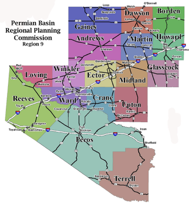
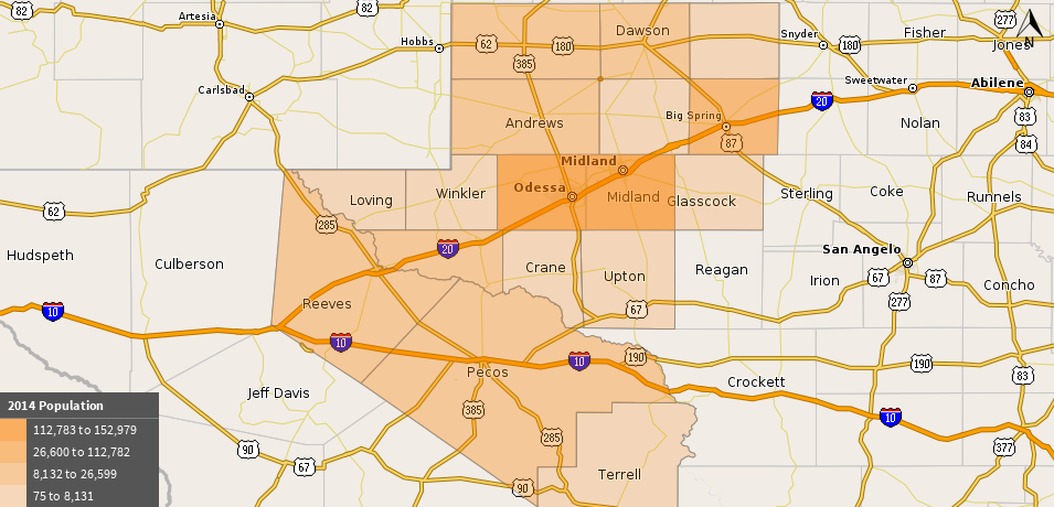
The Permian Basin multi-county region consists of 17 counties: Andrews, Borden, Crane, Dawson, Ector, Gaines, Glasscock, Howard, Loving, Martin, Midland, Pecos, Reeves, Terrell, Upton, Ward and Winkler counties. The region extends 250 miles wide and 300 miles long and consists of 23,484 square miles with a population density of 16.04 residents per square mile compared to a statewide density of 79.54 residents per square mile.
The Permian Basin is a sedimentary basin largely contained in the western part of the state of Texas. It is so named because it has one of the world’s thickest deposits of rocks deposited from the Permian geologic period. Although it is structurally a basin in the subsurface, much of the basin lies under the Llano Estacado and the northwestern portion of the Edwards Plateau, which are topographically high. On the west and south it extends across the Pecos River valley to mountain ranges in both New Mexico and West Texas. The southernmost county, Terrell, borders the country of Mexico along the Rio Grande River.
Because of good grasslands, most of the Permian Basin was inviting to both ranchers and farmers in the early days of settlement. Since surface water was almost nonexistent (0.1 percent compared to 2.5% statewide), ranchers and farmers drilled water wells to sustain themselves and their livestock and they often found evidence of oil or gas. Several oilfields were discovered in Upton and Crane counties in 1925, as a result of random drilling or surface and subsurface mapping. Today, the Permian Basin is a large oil and natural gas producing area, and considered a part of the Mid-Continent Oil Producing Area. The Texas Railroad Commission reports that in 2007, the Permian Basin accounted for 68% of the crude oil production in Texas.